Nepal renews push for Chinese glacier data after deadly Himalayan flood
Nepal is pressing China for more glacier and water-level data after a deadly flood, highlighting gaps in cross-border early warning systems.
Three months before a devastating glacial flood swept through a Himalayan valley on the Nepal-China border, officials from both countries met in Kathmandu to discuss disaster risk cooperation. The May 27 meeting brought together Nepali and Chinese experts, including representatives from Tibet, to talk about monitoring floods, weather, and glacier-related hazards.
Discussions focused on joint risk-reduction measures such as glacial lake inventories and hazard mapping. However, Nepali officials say they have not received the level of information they sought on glacier movements and water levels since that meeting. Sauhardra Joshi, a hydrologist at Nepal's Flood Forecasting Division, said Kathmandu wants early warning of any glacial movement in the region.
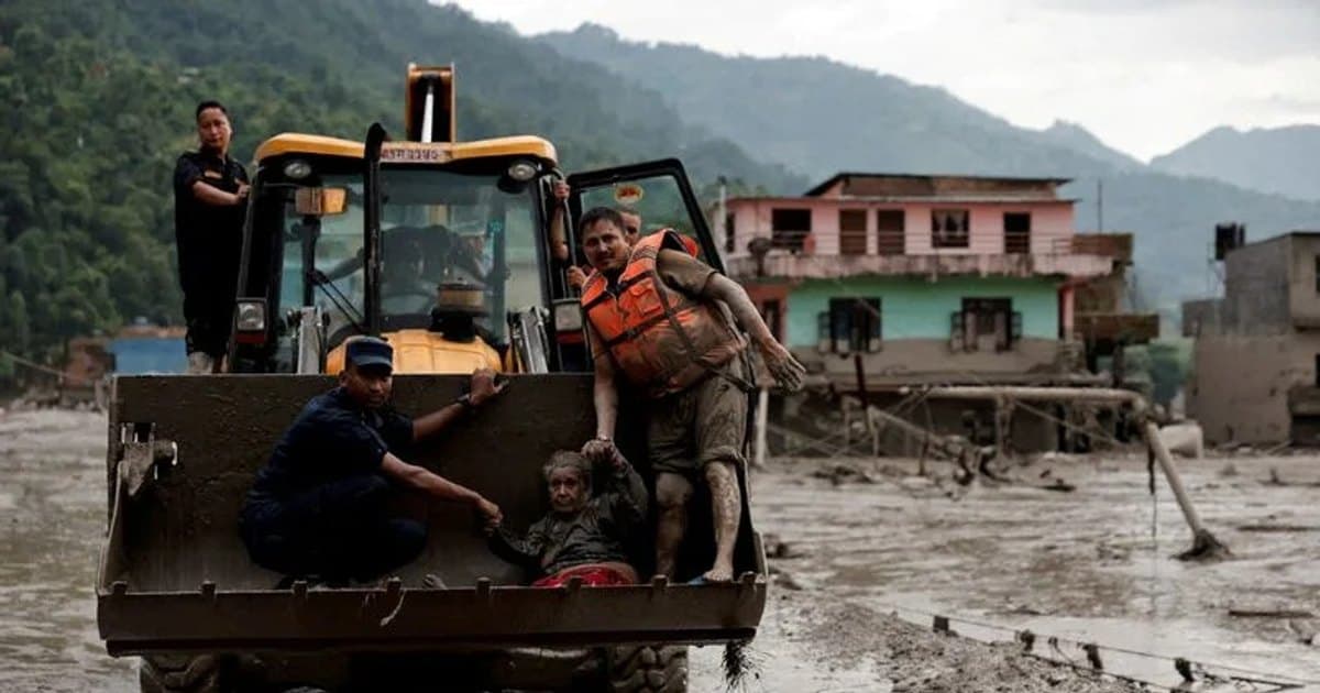
Last week's disaster, triggered by the collapse of a glacier on Nepal's Langtang mountain range, sent a wall of mud, water, and rock downstream, killing more than 900 people. Nearly 5,000 remain missing on both sides of the border. The flood damaged 19 bridges, knocked out over 10% of Nepal's power generation capacity, and is expected to cost a tenth of the country's annual economic output to recover from.
Chinese experts acknowledge the difficulty of predicting such events. Fan Xuanmei, director of the State Key Laboratory of Geohazard Prevention at Chengdu University of Technology, told state media that detecting such failures before they occur is extremely difficult. Potential source areas are often above 5,000 metres, where field monitoring is challenging and satellite observations can be limited by snow, ice, and steep terrain.
China's embassy in Nepal said Beijing and Kathmandu have kept in close contact and made "substantial progress" at the May meeting on cross-border disaster information sharing. It rejected criticism that China failed to provide adequate warning, saying Chinese teams had shared important information "in a timely manner."
Nepali hydrologist Binod Parajuli said China began sharing heavy rainfall forecasts for Tibet via the WeChat messaging app and email about a month ago. However, he noted that information on avalanches, water levels, and landslides is not included. Twelve days before the disaster, China's World Meteorological Centre warned Nepali officials by email of a monsoon depression forecast for the area, drawing attention to potential landslides and flash floods.
The flood reached Nepal's border crossing at 8:32 a.m. local time on Wednesday. Parajuli received an alert 26 minutes later, but a border monitoring station had stopped transmitting data. His team sent a public alert to mobile phone users at 9:13 a.m. At least four monitoring stations were destroyed by the flood, which carried 57.4 million cubic metres of water downstream.
Experts say the lack of a well-articulated data-sharing system between Nepal and China is a concern, though it was not a significant factor in this particular disaster. Austin Lord, a senior fellow at the Stimson Center, noted that Chinese scientists have greater capacity and resources for monitoring than their Nepali counterparts. The discussions underscore the complexity of early warning in a region where geopolitical rivals control remote mountainous areas holding vast ice and snow that loom over densely populated plains.