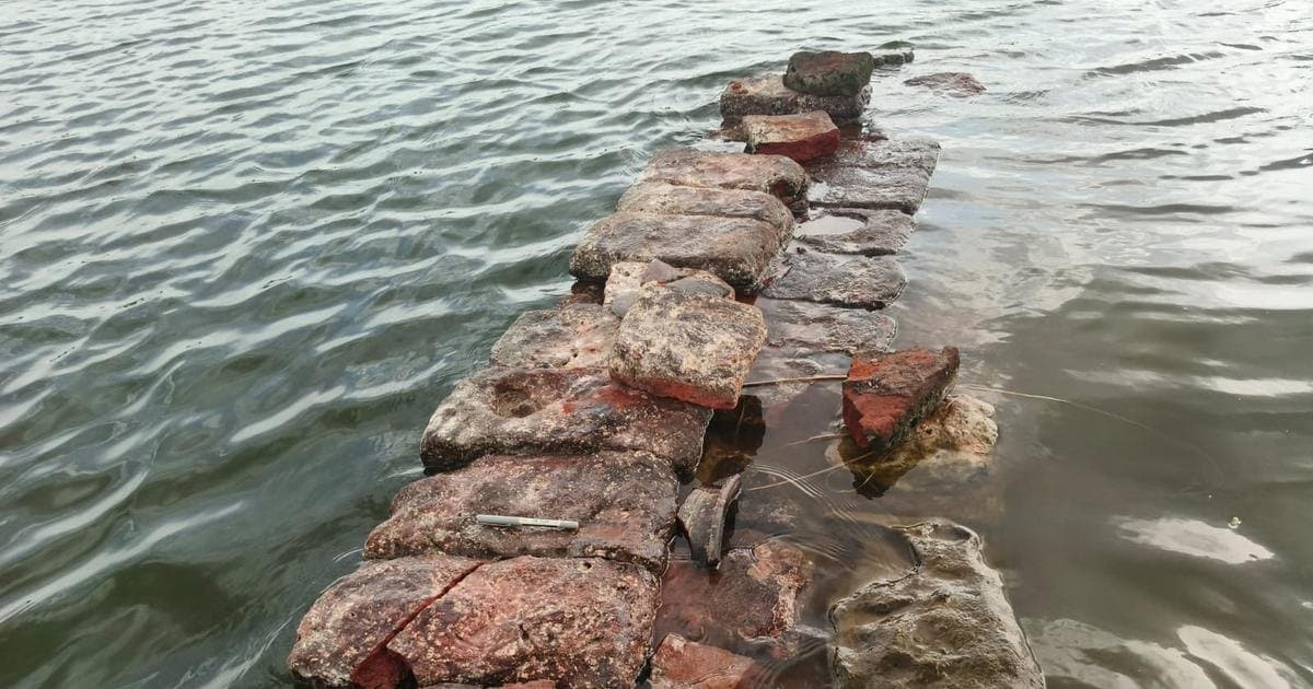
Sangam-era brick structure in Kollidam riverbed was a water regulator, says study
A brick structure exposed in the Kollidam riverbed near Lalgudi has been identified as a Sangam-period water regulation structure by the Tamil Nadu State Department of Archaeology.
A detailed investigation by the Tamil Nadu State Department of Archaeology (TNSDA) has determined that a brick structure recently exposed on the bed of the Kollidam river at Koogur, near Lalgudi in Tiruchi district, is a water regulation structure dating to the Sangam period. The site lies close to the ancient Kallanai dam.
The structure came into partial view last month after water levels in the Kollidam receded. A team of experts, including the department's Joint Director, Academic Adviser, Assistant Director, and an Archaeological Officer, conducted the study over two days in August. They used sonar to detect submerged extensions and deployed trained divers to examine underwater portions and document the structure's dimensions and construction.
Located roughly 100 metres from the river's northern bank, the structure consists of two sections. The first runs west to east for about six metres before curving north for 8.3 metres. It is approximately 1.75 metres wide and 1.04 metres high, with 13 courses of bricks visible; its northern part remains buried under sand. The second section, about 11 metres away, runs parallel, is about 2.15 metres wide, extends east to west for 6.5 metres, and curves north for about 4.5 metres. Six courses of bricks are visible in its western portion and three in the eastern portion. The eastern side of the riverbed is slightly higher than the western side.
The bricks measure roughly 39–43 cm in length, 20–22 cm in width, and 6–7 cm in thickness. These proportions are comparable to bricks found at other Sangam-age sites, including Arikamedu, Keeladi, Mangulam, and Poompuhar.
Based on its design, dimensions, and location, the structure is believed to have been built for water management during the Sangam period. A similar structure was previously exposed during excavations at Poompuhar. The study links the find to the Kurampu, a water-management feature comparable to a check dam, referenced in literary and inscriptional sources. Such brick structures were later replaced by stone anicuts and, during the British period, by iron sluices.
Because the Kollidam lies at a lower level than the Cauvery, researchers suggest an early structure may have been built across the connecting Ullar river to regulate the flow of Cauvery water into the Kollidam. Further exploration is possible only when water levels drop further. Earlier last month, experts from the Archaeological Survey of India's Tiruchi Circle had also studied the exposed structure and suggested it could be a Sangam-period irrigation feature.