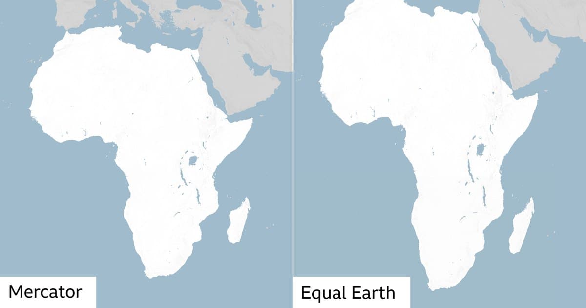
UN endorses mapmaking shift to reflect true size of continents
The UN has approved a resolution supporting world maps that show continents at their true scale, with India backing the African-led initiative and the US voting against.
The United Nations has passed a resolution endorsing a move towards world maps that depict continents closer to their actual geographic size, a change that would visually shrink Europe and enlarge Africa on standard projections.
The resolution, spearheaded by African nations, received broad support in the General Assembly. India was among the countries that voted in favour of the initiative, which challenges the conventional cartographic representation that has long dominated atlases and classrooms.
The only country to vote against the resolution was the United States, leaving it isolated on the issue. The vote signals growing international consensus on the need to correct the distortions inherent in widely used map projections, which tend to exaggerate the size of landmasses in the northern hemisphere while underrepresenting those near the equator.
While the resolution does not mandate a specific map standard, it reflects a diplomatic push to align global visual literacy with geographic reality. The outcome is seen as a symbolic but significant step in recognising the scale of continents as they truly exist on the globe.